The Saudi Sinai: More of the “Evidence”

Posted on:

Modified on:


  1. Ron Wyatt
  2. Previous articles in series
  3. Additional “evidence” for Saudi Sinai
    1. The Nuweiba crossing
      1. Nuweiba alternatives
      2. A land bridge at Nuweiba?
      3. The Nuweiba pillars
      4. Wheels and bones
        1. Wagon wheels
        2. Wagon wheels or hand wheels?
        3. Bones
        4. Why at Nuweiba?
    2. Additional claims on or near the mountain
      1. Pictographs
      2. 12 pillars
      3. Elijah’s Cave
  4. Wyatt’s museum

I have previously published two somewhat lengthy articles about Ron Wyatt’s “Mt. Sinai” at Jabal at-Laws in northwest Saudi Arabia. Discussions of Mt. Sinai on Facebook’s popular archaeology sites are often disrupted by people (never archaeologists) stating confidently that “the real Mt. Sinai is in Saudi Arabia, and there is a ton of proof!” Tim Mahoney of Patterns of Evidence, who I admire, has endorsed the Saudi site, though he is skeptical of Wyatt’s honesty.

I personally favor the traditional Jebel Musa (“Mountain of Moses”) site in the southern Sinai Peninsula. I could be wrong, but the evidence I see, while not proof, is compelling. I’m very convinced that it is not in Saudi Arabia!

Ron Wyatt

The late Ron Wyatt (June 2, 1933 – August 4, 1999) was a nurse-anesthetist working in the Nashville, TN area. In 1960, he saw a Life Magazine photo of a geological formation near Turkey’s Mt. Ararat shaped like a large boat. He decided on the spot that he wanted to become an “archaeologist.” He quit his job, traveled to Turkey, found the formation, and claimed that he had just discovered the true Noah’s Ark. He spent much of his remaining life in the Middle East, claiming to have made around a hundred discoveries, many of them of amazing importance.

Wyatt has a very wide following around the world among Christians who are enthralled by his astounding claims. I have heard him lovingly described as “God’s own archaeologist.” In his videos, he always appears humble and sincere, and even sheds tears as he talks about being privileged to have literally met with Jesus, face to face, in the flesh. Really?

Unfortunately, his discovery claims are based solely on superficial appearance. If it looks like a duck, then by golly, it must be a duck! Real archaeology, even if it starts with a visual identification, requires extended scientific testing to establish age, provenance, composition, and other applicable characteristics. Data must be carefully collected and evaluated, meticulously documented, and verified by experts in appropriate fields. Though Wyatt usually claimed to have followed these steps, his only witnesses were his own family and associates, and ultimately, he always found excuses for never producing any proof that he actually did so.

Wyatt was a member of the Seventh Day Adventist denomination. That organization is very interested in archaeology but, whatever you think of their theology, they are Christians of integrity, and they were embarrassed by Wyatt’s many deceptive and quite unbelievable claims. Therefore, in the months immediately before his unexpected death from colon cancer, two of the Adventists’ intellectual leaders, the brothers Russell and Colin Standish, researched and wrote a book to quietly, and as respectfully as possible, refute Wyatt’s claims: Holy Relics or Revelation: Recent Astounding Archaeological Claims Evaluated, Hartland Publications, 1999. Even discarding frequent references to the works of Sister Ellen G. White, 1827–1915, founder of the denomination and believed by them to be an inspired prophet, the book does an excellent job of stating the case against Wyatt.

Previous articles in series

As stated above, I have previously published two articles about what I have called, “the Saudi Sinai.”

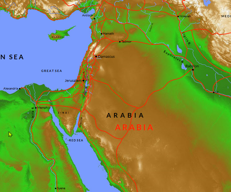
The first, “Moses, Paul, Sinai, Midian and Arabia“, June 4, 2022, addressed the issue of Paul’s statement in Galatians 4:25 that Mt. Sinai was located in Arabia. Most people anachronistically equate “Arabia” with the current country of Saudi Arabia, which came into existence in the 20th century. My article shows that both Arabia and Midian extended into the Sinai Peninsula in both ancient and classical times.

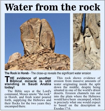
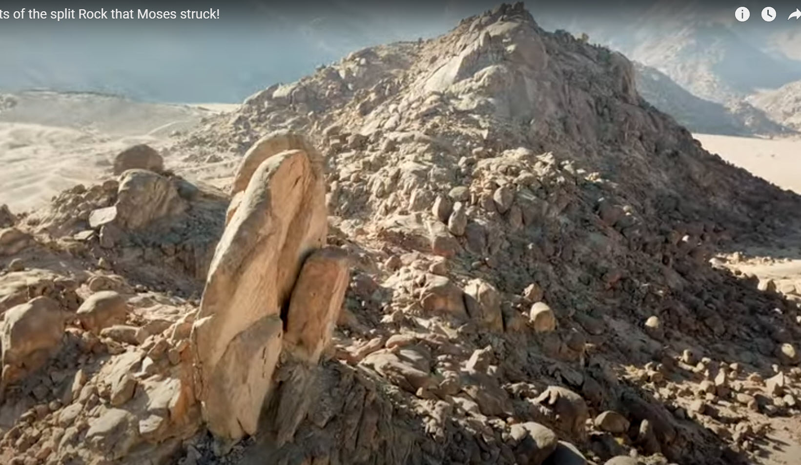
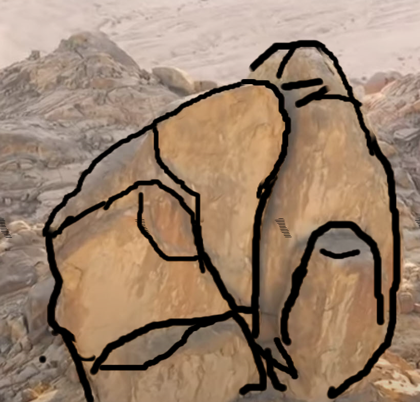
The second, “Geology and the Saudi Sinai“, December 13,2022, discussed in depth two of the most frequently cited “proofs” for the Saudi Sinai: the so-called “burnt mountain” and the nearby “split rock.”

Additional “evidence” for Saudi Sinai

In the remainder of this article, I will mention, as briefly as I can, other “proofs” of the Saudi Sinai offered by Wyatt.

The Nuweiba crossing

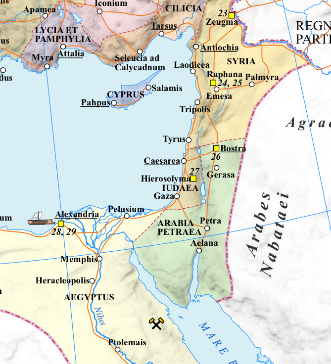
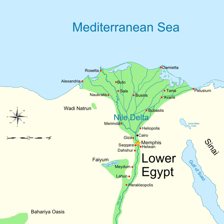
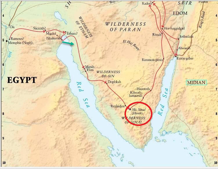
Wyatt and those who follow in his footsteps believe that the Israelites followed the route shown below in Fig. 1 and crossed the Yam Suf (the “Sea of Reeds“, incorrectly translated by KJV as “Red Sea“) at a wadi delta called Nuweiba Beach.

Fig. 1: Wyatt’s proposed route from Egypt to the Reed Sea Crossing. From evidence-for-the-bible.com.

Patterns of Evidence elected to promote this route and an Aqaba crossing largely based on evidence presented by Dr. Glen A. Fritz, holder of a PhD in Environmental Geography from Texas State University. In his 2016 book, The Lost Sea of the Exodus: A Modern Geographical Analysis, Dr. Fritz insisted that the term, Yam Suf, is only known to apply to the gulf of Aqaba, never to any other body of water.

I was skeptical of this claim from the first time I heard it, because it conflicts both with ancient historical naming principles that I’ve long been aware of and with modern oceanic map usage that I learned as a Naval officer. Today, the terms “Gulf of Suez” or, variously “Gulf of Aqaba“, “Gulf of Eilat“, or “Gulf of Elat“, are used, and appear on maps, but these appear as offshoots included as part of the greater Red Sea.

Similarly, the “Great Sea” of antiquity, now known as the “Mediterranean Sea,” is the all-inclusive body of water stretching from the Strait of Gibraltar to the shores of Syria, Lebanon and Israel, and which encompasses and includes a number of named minor seas like the Ionian, the Aegean, the Adriatic, etc.

My own belief has been and still is that the Sea of Suf included the entire Red Sea region and even into and beyond the Gulf of Aden. It seems likely to me that it (the Sea of Reeds, Yam Suf) probably got its name from floating masses of reeds washing in and out of the tidal estuary north of Suez City to and beyond the Bitter Lakes. Near Egypt, the most populous area in the entire vicinity.

A scholarly 2020 book titled, Where Was the Biblical Red Sea: Examining the Ancient Evidence, by Dr. Barry Beitzel, professor emeritus of Old Testament and Semitic Languages at Trinity Evangelical Divinity School, was written primarily to refute both the methodology and the conclusions of Dr. Fritz’ book. It essentially states what I already believed, but with much background and historical support.

Nuweiba alternatives

Several locations have been proposed for the “Red Sea Crossing” site. From north to south:

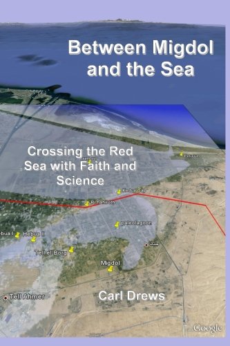
  • The site favored by Tim Mahoney’s sidekick, archaeologist David Rohl, is the shallow Lake Tanis, in the Nile Delta. David got very angry at me for disagreeing on this, so don’t tell him that I later wrote a more formal refutation in God with the Wind.
  • The site favored by most scholars from the last century more or less, is the tidal Bitter Lakes region, quiescent since the Suez Canal was opened and disrupted normal tidal flows in the estuary. I think that this location, like Lake Tanis, was originally proposed due to reluctance to believe in a significant miracle. Conservative Evangelicals tend to go along with this choice, hopefully due to ignorance of the argument’s history.
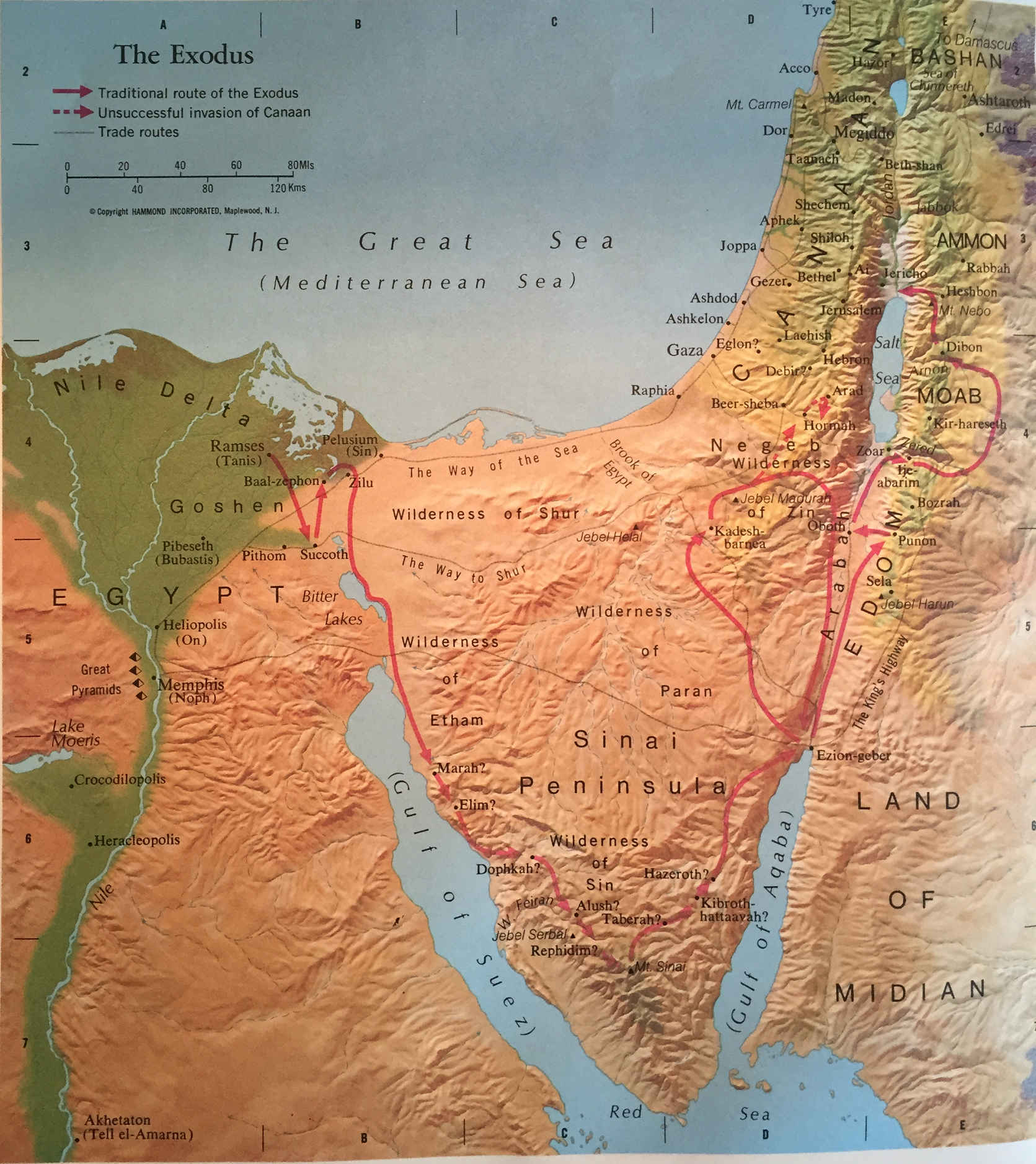
  • The traditional site, and my favorite, is the crossing near the northern tip of the Gulf of Suez, shown below in Fig. 2.
Fig. 2: The traditional route of the Exodus, showing a crossing in the northern Gulf of Suez, near Suez City. I added the green arrow to show an alternate routing in the same region; this route is longer and deeper, but certainly doable for God. Skeptics argue that either of these two alternatives is “impossible” since the wind to hold back the water would be too strong for human survival. But in God with the Wind, I argue that the wind only accompanied the miracle, rather than being causative.
A land bridge at Nuweiba?
Fig. 3: Gulf of Elat (Aqaba), depth of water, Geological Survey of Israel.

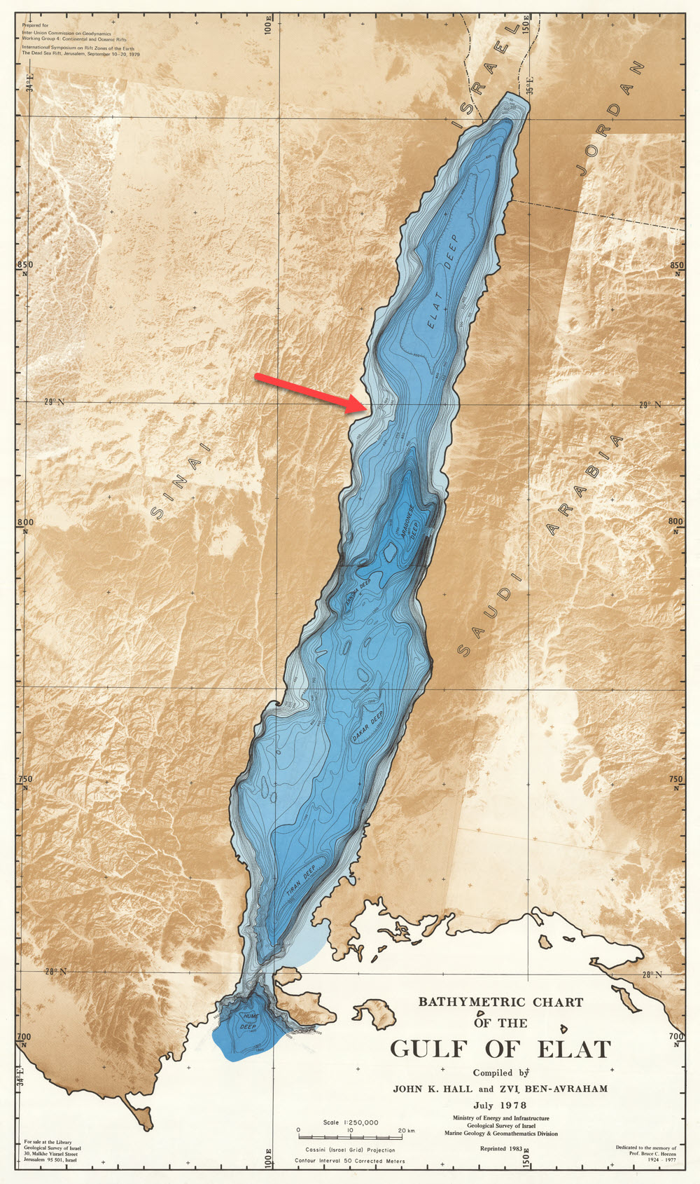
The crossing favored by Wyatt is at Nuweiba Beach, on the Gulf of Aqaba, a.k.a., the Gulf of Elat, or Eilat, Fig. 3.

The annotated red arrow points to this beach, a small delta on the western shore. Though difficult to read at the scale shown, the deepest point in the crossing area is in excess of 900 meters, more than a half mile!

More importantly for the Israelites: Even if God dried a path there for them, they would have had to navigate a steep gradient, almost a foot for every three-foot stride, near the eastern shore. Imagine moving heavily laden wagons and animals up such a steep slope for several miles.

By terming the shallow saddle between opposite banks of the Gulf a “land bridge”, Wyatt prejudiced the argument in his favor. Technically, a land bridge is “a strip of land [above the normal waterline] connecting two landmasses” (per Merriam Webster). Even if one loosens this definition to include land that breaks the surface only at low tide or during a draught, Nuweiba doesn’t even vaguely qualify.

The Nuweiba pillars
Fig. 4: Granite pillar on Nuweiba Beach, said to be erected by Solomon, but exhibiting no markings. Concrete pad added in 1978. Ron Wyatt is the white-haired man in field khakis, his back to the pillar. arkdiscovery.com.

Wyatt claimed to have found a stone pillar on Nuweiba Beach and a second stone pillar on the opposite shore, both erected by King Solomon to memorialize the crossing at that location. The circumstances of this discovery are as follows:

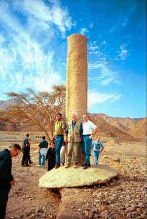
He first discovered the pillar on the Beach (west) side of the gulf in 1978. It was a “Phoenician-style” granite column bearing no markings whatsoever (he said they had either been eroded off or chiseled off by persons unknown), and it was laying on its side next to the road. After mentioning it to the local military officials, they poured a concrete slab and set the pillar upright, Fig. 4.

A Saudi military helicopter later flew Wyatt to the east bank, where he found a matching pillar, but with its markings intact. In Phoenician (Proto-Hebrew) script, it exhibited the words: Egypt, Slomon, Edom, death, Pharoah, Moses and Yahweh. Of course, there is no substantiation that this pillar ever existed.

According to Wyatt, the Saudi authorities removed it before anyone thought to take photographs. So, what does it prove? Only that Ron Wyatt was never an archaeologist!

Wheels and bones

Ranking the “evidence” for Wyatt’s Saudi Sinai, chariot wheels and bones, human and horse, under water at the Nuweiba “crossing” site have to be no deeper than third on the “most talked about” list.

Wagon wheels

Are they really there? Well, yes, a few of them. That was verified by Patterns of Evidence. Fig. 5 is the best photo I could come up with. Wyatt’s best wheel photos were all invalidated as even potential evidence by being photoshopped. To be considered evidence a wheel would have to be brought to the surface and cleaned off, at minimum. Until then, it can only be assumed that there is a wheel beneath the coral, and until a recovered wheel is C14 dated and otherwise tested at a professional lab, nothing there qualifies as evidence, only as a discussion topic.

Fig. 5: Coral-encrusted wagon wheel off the coast of Nuweiba, arcdiscovery.com.

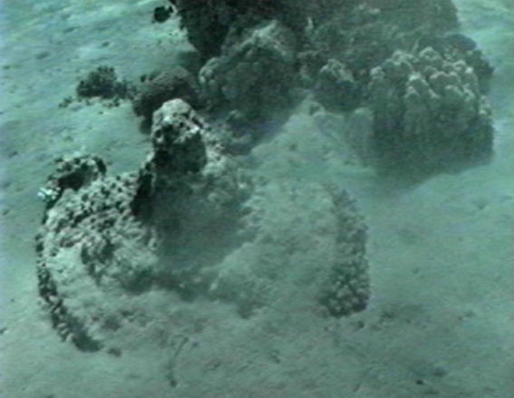
But assuming they are wheels (which seems reasonable), are they chariot wheels? War chariots were specifically designed for rapid travel on well-worn or paved roads, and for fighting on more or less level surfaces. They were of no use on rocky, mountainous, or grossly uneven terrain.

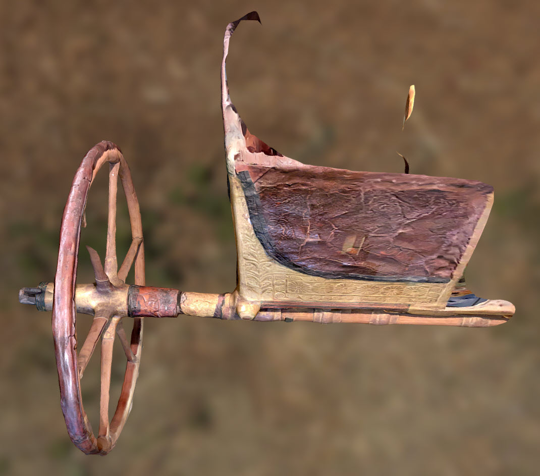
Fig. 6 shows a 3D rendering of an “anatomically correct” Egyptian chariot from the 18th dynasty. The components, including the wheels, were kept as slender as possible for the sake of speed and agility. The wheel rims and spokes were laminated for strength and suppleness. Leather “tires” were added for additional strength and to dampen vibrations. Leather sleeves also strengthened the axles. The hubs were reinforced by hammered bronze girdles.

Fig. 6: Partial 3D scan of the Egyptian chariot of Yuya from the 18th Egyptian Dynasty during the New Kingdom. Along with his wife Thuya, they were the parents of Tiye, who was the Royal Wife of Amenhotep III. ©Nate Loper.

In contrast, the “wheel” in Fig. 5 appears to be too bulky to be anything more warlike than a wheel from a cart or wagon, probably pulled by oxen.

Wagon wheels or hand wheels?

Fig. 7 is another artifact found at offshore Nuweiba. Wyatt supporters claim that it is a golden chariot wheel, presumably off of Pharaoh’s chariot. Coral and other encrustations, they claim, will not stick to gold. These claims are pure amateur foolishness.

Fig. 7: A golden chariot wheel?!

Why foolish?

  • Coral can surround and ingulf any material that is submerged long enough in its presence.
  • Even pure gold will tarnish in salt water.
  • In a less than pure state, or when plating another metal, corrosion would quickly occur.
  • Pure gold is too malleable for use on chariot wheels.
  • Though wheel-shaped, this device is too thin in cross-section to be load-bearing.
  • It would require a lab test to be sure, but I’m guessing from the photo that this device was machined and therefore is recent.
  • I’d be willing to bet that it is stainless steel, not gold.
  • Since there is nothing in the photo to give it scale, it could be much smaller or larger than a chariot wheel.
  • My guess is that it is a modern industrial valve wheel handle (Fig. 8), something that I am personally very familiar with. I’ve worked with some that are very similar to what is shown in Fig. 7. Fig. 8 shows one that is powder coated for use indoors or outdoors but not submerged. Stainless handles are made for saltwater and submerged operations and are sometimes easily as large as a chariot wheel.
Fig. 8: Replacement handle for an industrial gate valve. Ellis Irrigation LTD.
Bones

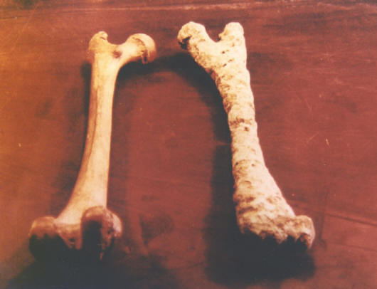
In addition to wheels, it is claimed that human and horse bones have been recovered under the waters at Nuweiba (see Fig. 9). I’m not aware if there has been any independent verification of that claim.

Fig. 9: Human leg bones. It is claimed that the encrusted bone on the right was recovered off Nuweiba. The bone on the left is a “normal” bone for comparison. arcdiscovery.com.
Why at Nuweiba?

The next question to be answered is, why at Nuweiba? Given the paucity of specimens, Nuweiba hardly qualifies as underwater graveyard, but why are they there at all, if they weren’t an Egyptian army “swept under” by God?

This is easy to answer! The Gulf of Aqaba is not an erosion feature, having no major rivers. It is a fault line that is slowly pulling apart due to plate tectonics. Water currents in the Gulf are almost entirely due to tidal flow through the Strait of Tiran (Fig 10:). The result is a gentle north/south wash, peaking at around 7 miles per hour each direction.

Fig. 10: Daylie tidal flow in the Gulf of Aqaba. ©Journal of Geophysical Research.

The city of Eilat, at the northern tip of the Gulf, has been occupied since prehistoric times, and has been an important seaport for most of that time, exchanging goods with northern regions via the ancient King’s Highway and with southern regions via Red Sea shipping lanes. All busy shipping lanes experience occasional shipwreck due to storms, collisions, groundings, military actions and other mishaps. Since military equipment has always been a frequent trade category, it is inevitable that chariots and wagons, as well as dead humans and horses, ended up in the water.

When boats or other wooden structures are swamped, they float for a time, and then as water soaks into the pores, they eventually tend to lose buoyancy and slowly sink. Freshly dead bodies may float awhile unless they are heavily encumbered, then they, too, begin to sink. As they decompose, gases accumulating in body cavities will cause them to eventually float back to the surface. I’m sure that research would show a tendency for semi-buoyant objects to collect on the undersea shelf at Nuweiba over time.

Additional claims on or near the mountain

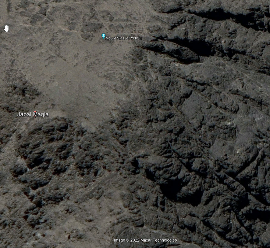
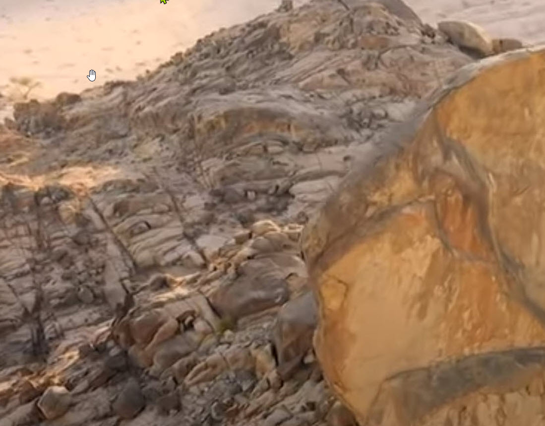
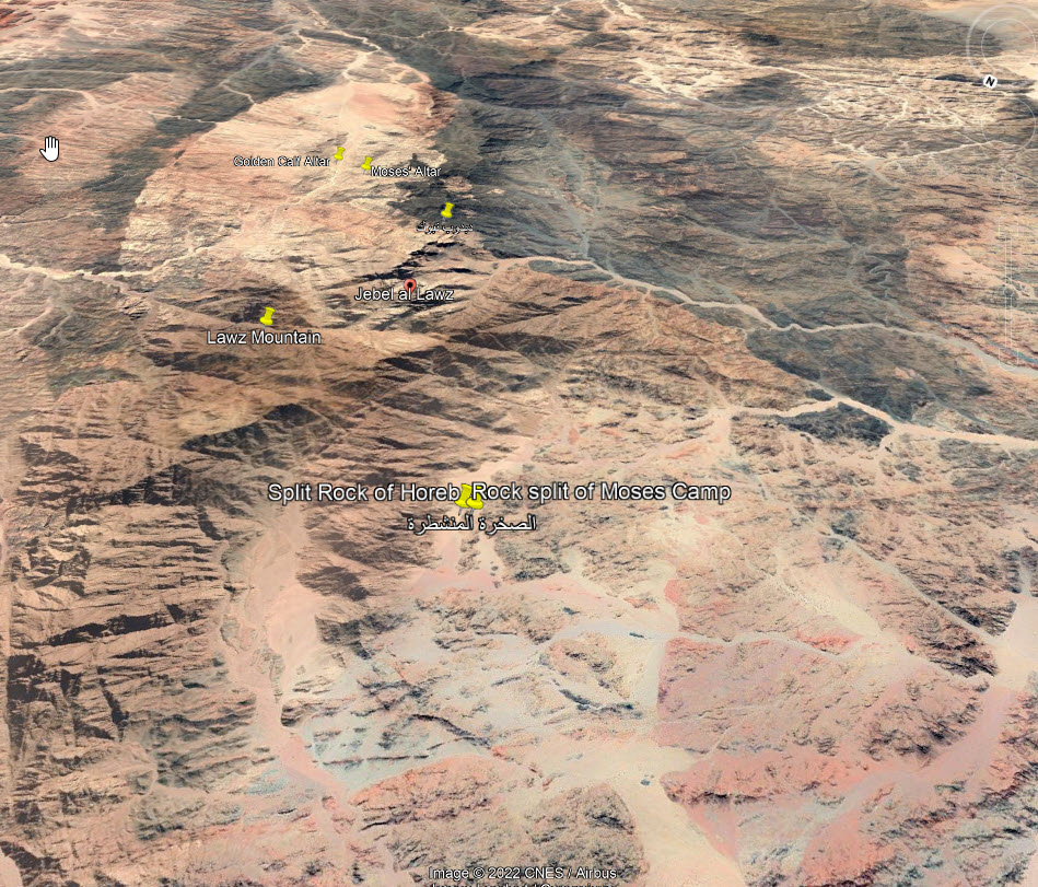
In addition to the blackened mountaintop (basaltic lava flows) and the split rock (frost wedging and exfoliation of a glacial “erratic” perched on a glacial moraine), other findings in the area of Jabal al-Lawz have been cited as evidence for Mt. Sinai in Saudi Arabia.
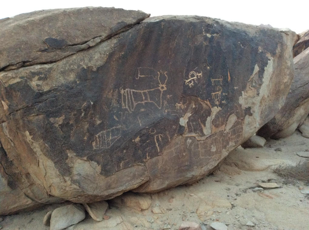
Pictographs

The pictographs near Al-Lawz, Fig. 11, may be associated with ritual, but most likely they are simply graffiti. Possibly ancient, but I doubt that any attempt has ever been made to scientifically date them.

But similar pictographs have been found all over the Arabian subcontinent, not to mention the entire world. I grew up less than an hour’s drive from ancient Anasazi pictographs in New Mexico.
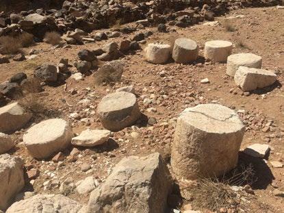
Fig. 11: Pictographs near the base of Jabal al-Lawz.
12 pillars

Exodus 24:4 (ESV)
[4] And Moses wrote down all the words of the LORD. He rose early in the morning and built an altar at the foot of the mountain, and twelve pillars, according to the twelve tribes of Israel.

It’s funny how many people read a verse like that and immediately assume that Moses built an elaborate worship area with shaped stones and formal pillars like a Pharaoh, or Herod the Great, would commission. But the verse above sounds like a one-day project to me.

For the previous 40 years of his life, Moses had lived rustically as a nomadic desert herdsman. The way I picture it, he got up in the morning, collected and stacked stones into a rough altar and 12 cairns, or perhaps 12 oblong standing-stones.

There is actually no reason whatsoever to connect these stones (Fig. 12) with Moses and the Exodus. The Saudi government and nearby residents have suggested alternative explanations that are as plausible or more so than Wyatt’s.

Fig. 12: Ruins of some unknown structure at the foot of Jabal al-Lawz.
Elijah’s Cave

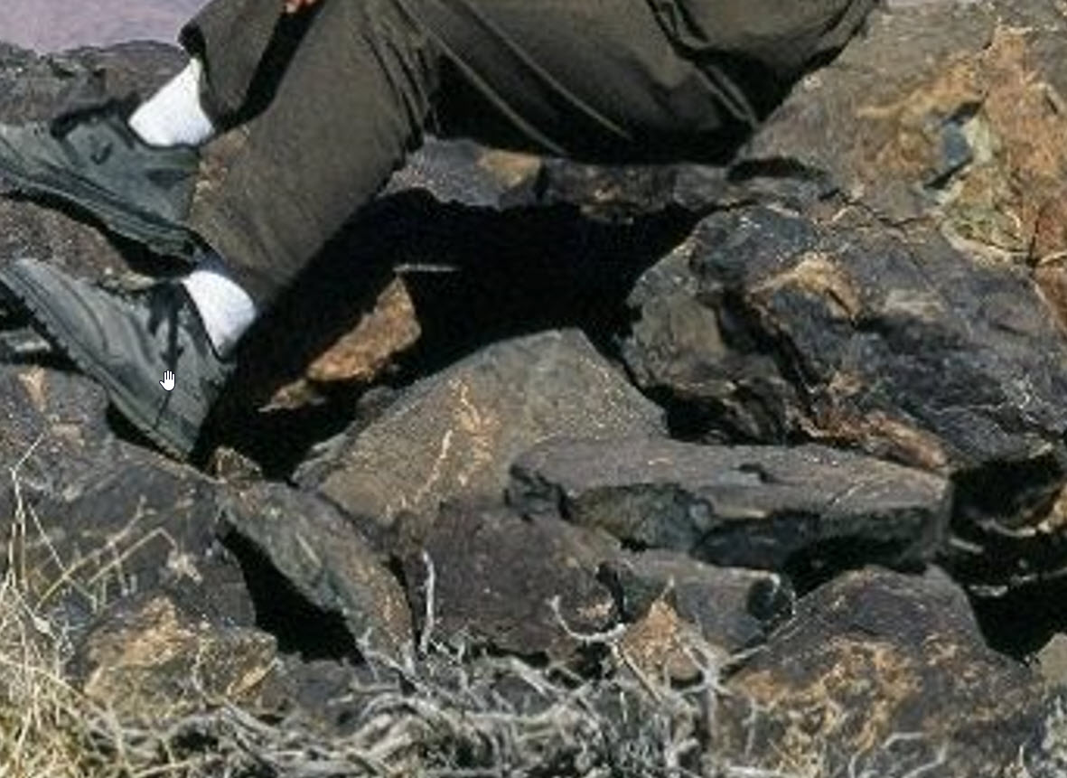
1 Kings 19 describes Elijah’s flight from Queen Jezebel to a cave on Mt. Horeb, a.k.a., Mt. Sinai. And, Glory be, there it is, on the side of the Saudi Sinai (Fig. 13)!

Fig. 13: Cave on the side of Wyatt’s Mr. Sinai, above the region with the pillars. ©Doubting Thomas Research Foundation.

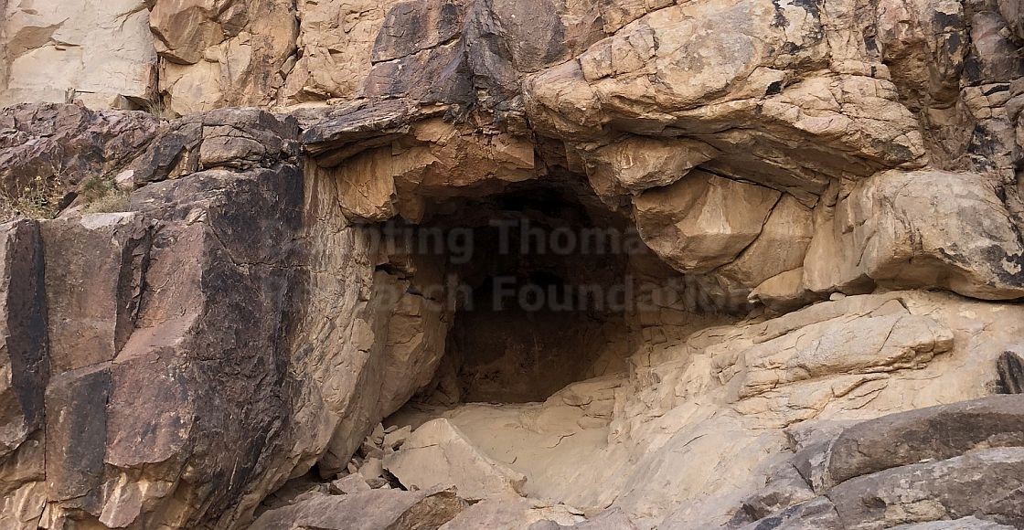
Not so fast! The whole area around the Red Sea, northwest Saudi Arabia, the Sinai Peninsula, up the Jordan Valley, and even into Iraq, Anatolia and Eastern Europe is tectonically active. Fissures and caves come and go with each earthquake, and there have been many of those!

There’s no evidence here!

Wyatt’s museum

Fig. 14: Wyatt Archaeological Museum

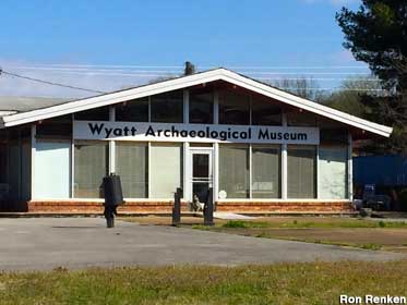
The Wyatt Archaeological Museum in Cornersville, TN (Fig. 14), now permanently closed, was given rave reviews by Ron Wyatt’s fans, but as far as I can tell from many interior photos, the only legitimate archaeological specimens it contained were inexpensive tourist items available from any antiquities shop in the Middle East.

There were several mildly interesting but worthless mockups and scale models. The best of those was a full-scale model of an Egyptian chariot, much like the famous chariot from King Tut’s tomb. Table loads of trivia and trinkets. Every bit of wall space had new clippings, posters, or blowups of snippets from his videos.

Now, it’s closed, and its web site is shut down.


Geology and the Saudi Sinai

Posted on:

Modified on:

  1. The “Burnt Mountain”
    1. Geological origin
    2. A North American analog
  2. The “Split Rock”
    1. Glacial origin?
    2. Is the split miraculous?
    3. Erosion in and around the split rock
      1. Weathering of the megalith
      2. A supporting structure?
      3. A plinth for the split rock?
      4. Erosion of the rock piled beneath the split rock
      5. Erosion in the surrounding wadi

Fig. 1: Jabal Maqla (Jabal al-Lawz range, from livingpassages.com web site)

A topic that comes up over and over again on social media archaeology groups is the contention that the real Biblical Mount Sanai is the mountain Jabal al-Lawz in northwest Saudi Arabia.

This is one of around a hundred astounding finds claimed by the late Ron Wyatt, who left his job as a medical technologist in Tennessee to chase his dreams as an amateur archaeologist. I don’t think that even a single one of his claims is valid. What he did was travel around the Middle East searching for things that superficially looked like something described in the Bible. A real archaeologist would produce tangible evidence for the find. Wyatt usually claimed to have found such evidence, but if so, only his own eyes ever saw it.

I previously disputed the contention by Wyatt’s many supporters that the traditional site of Mt. Horeb/Sinai, Jebel Musa, on the Sinai Peninsula, cannot be correct because that area was part of Egypt, not Arabia as Galatians 4:25 seems to require (see Moses, Paul, Sinai, Midian and Arabia). I thought I would spend a little time and space here discussing Jabal al-Lawz and Wyatt’s “split rock” themselves from a geological perspective. (Note: I have subsequently written The Saudi Sinai: More of the “Evidence”, in which I dispute some of Wyatt’s other claimed evidence on the subject.)

I should state at this point that it is difficult to disprove something that cannot be proved in the first place. My purpose here is to offer a more sensible explanation of two of the main talking points used to justify the Saudi Sinai claims—the black mountaintop and the split rock. I offer no proof of my own contentions. I’ve never been on that site, so all I can provide is sound principles and other folks’ photographs and research.

The “Burnt Mountain”

The most striking feature of the Saudi Mountain is the black summit, which is claimed, based on a superficial visual impression only, to have resulted from God’s appearance over the mountain:

16 On the morning of the third day, there was thunder, lightning and a thick cloud on the mountain. Then a shofar [ram’s horn] blast sounded so loudly that all the people in the camp trembled.
17 Moshe brought the people out of the camp to meet God; they stood near the base of the mountain.
18 Mount Sinai was enveloped in smoke, because ADONAI descended onto it in fire — its smoke went up like the smoke from a furnace, and the whole mountain shook violently.
19 As the sound of the shofar grew louder and louder, Moshe spoke; and God answered him with a voice.
—Exodus 19:16–19 CJB (emphasis added)

Fig. 2: Peak of Jabal Maqla, the “Burnt Mountain”, doubtingthomasresearch.com.

There is some confusion as to the proper name of the mountain in question. Ron Wyatt, Bob Cornuke and others Applied the name Jabal al-Lawz to the mountain pictured above, but al-Lawz is a somewhat higher peak to the north of that pictured, which is correctly called Jabal Maqla, meaning “Burnt Mountain”. That’s a minor point. The major question is, why is the peak blackened? Is that, as claimed by Wyatt and his followers, a remnant of scorching by God’s presence in the lightning, fire and smoke recorded in Exodus?

My interpretation of the passage above is that the lightning may have been literal, or perhaps static electricity, but that the fire and smoke were simply God’s sh’kinah glory, the same phenomena as the pillar of fire and smoke that led the Israelites for 40 years and that is never recorded to have damaged anything.

Furthermore, the contention that the mountainside was burned and that the burned area would still be visible after 3500 years, is beyond implausible. Compare the fire on Mt. Carmel when Elija confronted the priests of Ba’al some 600 years later; no trace of that remains, and Mt. Carmel is a known location.

Then the fire of the LORD fell and consumed the burnt offering and the wood and the stones and the dust, and licked up the water that was in the trench.
—1 Kings 18:38 ESV

I have not been to the site of al-Lawz, but I have seen many photos, and I have read formal geological descriptions of the area, which is strikingly similar to portions of the Rio Grande Rift Valley in New Mexico, which I am personally well acquainted with, having grown up in Albuquerque.

Geological origin

Biblical Midian lies within the northwestern extremity of the Arabian-Nubian Shield, which is a granitic batholith, shown in gray below, that spans the Red Sea. Granite magmas solidify deep within the earth’s crust and are exposed by succeeding uplift and erosion. The Red Sea itself is a more recent rift zone, where plate tectonics (continental drift) is pulling northeast Africa and southwest Asia apart. Rift zones are always associated with volcanic activity, and this case is not different, as is also shown on the map, fig. 3.

Fig. 3: Distribution of northeast Africa and Arabia Cenozoic volcanism (researchgate.net, William Bosworth)

In reality, the blackened peak of Jabal Maqla is not due to scorching, but rather to lava flows, which are common along the rifting Red Sea and Jordan Valley. The geological literature describes the Jabal Maqla itself to be composed of a light-colored granite capped with volcanic rhyolite and andesite. The andesite is what makes the peak seem “burnt” (fig. 4). Rhyolite is a brown-colored lava which shows up on some aerial photos as volcanic dikes in older andesite flows.

Fig. 4: Andesite example, Photo ©Siim Sepp, 2005

The volcanic nature of the peak is particularly obvious from satellite imagery. The photos below (fig. 5 and the added fig. 5a) show the mountain and its surrounding drainage pattern. Note that the wadi on the north side is fed primarily from farther north, outside the blackened area. The tributary wadis that flow from the Jabal Maqla peak are paved with silt weathered from the darker andesite lavas.

Fig. 5: Jabal Maqla, Google Earth
Fig 5a (added): Clear view from southwest of obvious lava flows at Jabal Maqla. Google Earth.

Next (fig. 6) is a view cropped from a visitor’s photo, shot on the summit of Jabal Maqla. The partially weathered rocks they are sitting on are clearly volcanic in origin. To my eye they are primarily black andesite, with lighter colored rhyolite inclusions.

Fig. 6: Crop of 3rd-party photo taken on the summit. Source unknown.
A North American analog

For comparison, I am including as fig. 7 a photo of a typical New Mexico lava flow, from the region close to Carrizozo, south of my childhood home in Albuquerque.

Fig. 7: Carrizozo Little Black Peak, New Mexico Museum of Natural History & Science.

The “Split Rock”

Unnumbered (added): Article from unknown source.

The second geological feature in the area that I want to discuss is the “split rock of Rephidim“, which Wyatt followers claim to have found to the northwest of Jabal al-Lawz.

1 All the congregation of the people of Israel moved on from the wilderness of Sin by stages, according to the commandment of the LORD, and camped at Rephidim, but there was no water for the people to drink.
2 Therefore the people quarreled with Moses and said, “Give us water to drink.” And Moses said to them, “Why do you quarrel with me? Why do you test the LORD?”
3 But the people thirsted there for water, and the people grumbled against Moses and said, “Why did you bring us up out of Egypt, to kill us and our children and our livestock with thirst?”
4 So Moses cried to the LORD, “What shall I do with this people? They are almost ready to stone me.”
5 And the LORD said to Moses, “Pass on before the people, taking with you some of the elders of Israel, and take in your hand the staff with which you struck the Nile, and go.
6 Behold, I will stand before you there on the rock at Horeb, and you shall strike the rock, and water shall come out of it, and the people will drink.” And Moses did so, in the sight of the elders of Israel.
7 And he called the name of the place Massah and Meribah, because of the quarreling of the people of Israel, and because they tested the LORD by saying, “Is the LORD among us or not?”
—Exodus 17:1–7 ESV

The claim is that this (fig. 8ff) is the rock that Moses struck with his rod, causing water to gush out to satisfy the thirst of the Israelites. As proof, they offer that the rock is close to Horeb; it is huge; it is split roughly in two, top to bottom; and it shows “obvious signs of water erosion.” Scripture says nothing about the appearance of the rock. Nearness to Horeb (Mt. Sinai) is only proof if Jabal al-Lawz really is Horeb.

I will discuss the question of erosion, below, but first I want to mention the probable origin of the rock and the rubble base on which it rests. This will have some bearing.

Glacial origin?

My initial reaction when I first saw photos of this granite behemoth and its associated elongated mound of rubble was surprise at what appeared to me to be glacial deposits in the Arabian desert! It would take a geological survey to establish the truth of my conjecture, but after research, I determined that there is indeed evidence of Mid-Cryogenian (Neoproterozoan) glaciation in the northern Arabian–Nubian (A-N) Shield region. This was a “snowball earth” period, one of two periods when virtually the entire planet was covered by continental ice sheets. The surface geology of the A-N Shield at this time is represented in gray on fig. 3, labeled as the Proterozoic basement complex.

Factors that led me to my conclusion were (a) the gigantic boulder that I thought surely must be a “glacial erratic“, an out-of-context rock too big to have been deposited by almost any other means; (b) the ridge on which it rests, appearing to possibly be “glacial till“, which is a deposit of rubble “usually described as massive (not layered), poorly sorted, and composed of multiple types of angular to sub-rounded rocks”; and (c) horizontal surfaces polished by fine grit and striated by larger fragments carried along at the base of the glacier.

Fig. 8: Split Rock, from 3rd party drone clip. The surface of the rock beneath the boulder shows apparent striations and polishing.
Fig. 9: Split rock, from 3rd party drone clip. Seen on edge and showing part of an apparent till ridge, or “moraine”.
Fig. 10: Rubble underlying the split rock, from alvarolima.com
Is the split miraculous?

Probably not. Such splitting is a normal characteristic of “frost wedging”, where moisture penetrates a small hole or crack in a rock, freezes, and wedges the opening larger. The ice melts, more water enters, and the cycle repeats. Over time, even huge boulders (and this one is said to be as large as 60 feet in diameter) will split. I have seen literally thousands of split rocks in New Mexico alone. The splits are almost always vertical, like this, because the water flows under gravity in the rock. I’ll provide two examples here:

Fig. 11 is a granite boulder, no doubt another glacial erratic, in the arid Joshua Tree National Park, in California. Fig. 12 is a photo of what is now a popular climbing spot near Albuquerque. Frost wedging accounts for probably all of the fracturing seen here. I did not take this picture, nor am I a rock climber, but some 50 years ago I stood either on that spot or on one very much like it close by, after hiking up along the axis of the ridge with a friend. Imagine my terror…

Fig. 11: Frost wedging in Joshua Tree National Park, ©Randall Nyhoff
Fig. 12: Knife Edge granite shield outcrop, Sandia Mountains, New Mexico. ©Steven VanSickle.
Erosion in and around the split rock

Descriptions of this rock always say there is “obvious water erosion” associated with it. Doubting Thomas Research Foundation (DTRF) is one organization that was apparently established by an individual to promote Jabal al-Lawz and its features. In one article they state about the split rock, “The erosion is within this split, along several paths descending from the base of the rock, and in the front and back of the hill at the bottom.” I will respond to this by commenting on photographic evidence I have seen.

Weathering of the megalith

Transportation of glacial till is slow and involves pushing, rather than rolling or tumbling. Rocks embedded in the till might become fragmented, or partially fractured, or chipped at the corners, but only roughly rounded. If sandwiched between ice and the underlying rock surface, polishing and scoring may result. I am assuming that the split rock is a glacial erratic that ended up at the top of the pile when the glacier melted. Sitting there, in that environment, it would have been subjected to three major weathering agents: frost wedging, exfoliation, and wind abrasion. The latter of these is mostly ineffective against hard igneous rocks.

However, both frost wedging and exfoliation are evident here. First, the frost wedging that I discussed above is undoubtedly responsible for the big split, and also for the oblong rock fragments littering the floor of the split, as well as the angular fissures in the walls of the split, as shown in fig. 13, below. I have also seen video footage of thin flakes of rock on the split’s floor. This was obvious debris from exfoliation—the eggshell layers that can be clearly seen in fig. 13.

Fig. 13: Floor of the Saudi “Split Rock”, showing exfoliation of the rock face. ©JohnTrifBrent.

Fig. 14 exhibits exfoliation on the external surfaces of the megalith, and on the rocks in the photo’s foreground. Exfoliation is due to heating and cooling of the rock itself, as opposed to thermal cycling of water in rock fractures. Temperature changes within the rock will be felt more quickly at the surface than under it, causing differential expansion and contraction. Since the granite is crystalline and brittle, an outer “skin” will eventually separate from its substrate. Such flakes, still clinging to the surface, can be seen in both photos, fig. 13 and fig. 14. Weathering by exfoliation typically rounds the surface of boulders. A great example of this is the Half Dome pluton, in Yosemite National Park.

Fig. 14: Exfoliation of the rocks
A supporting structure?

DTRF (see above) also makes the following observation: “At the top of the hill, on one side of the split rock, is a large rectangular rock that may be holding the split rock upwards. In theory, this rectangular rock may serve a logistical (sic) purpose if the Exodus story is accurate. It would hold the split rock up for the scene to take place, as well as provide a safe spot for Moses to stand after striking the rock.

Referring back to fig. 8, I assume that the author is referring to the vertical block immediately in front of the split rock, on the right or more probably the horizontal block on the left. From the photos I’ve seen, I would presume these to both be merely additional segments of the same boulder. Both are effectively separated from the main “lobes” of the boulder by wedging surfaces. To clarify, I have very roughly sketched what I see as the edges of major wedging planes in fig. 15.

Fig. 15: Wedging boundaries in split rock megalith. The shaky hand is mine.
A plinth for the split rock?

Of more interest to me, shown in fig. 16 (a crop of fig. 8), is the more or less flat surface that the megalith is sitting on. The regularity of the apparent cross-hatching on top of this rock surface suggests a striated and polished surface caused by dragging at the base of the glacier.

Fig. 16: Striated rock beneath the split rock.
Fig 17: Example of glacial striations and scouring, in high mountain terrain.
Erosion of the rock piled beneath the split rock

DTRF also noted erosional channels on “several paths descending from the base of the rock“. Other visitors to the site frequently mention such paths, or troughs, running from the split rock, down the face of the rubble, to the wadi below. The more astute acknowledge that this could be due to millennia of natural runoff. Others insist that there is not enough rain in the region to account for the erosion they see on the slope. Some visitors evidently account for the rubble-strewn mound itself by appealing to a strong flow of water from the rock after it was split by Moses’ rod.

I have seen one such erosional channel on video, but as a former desert-dweller, I have to say that it is not very impressive, and not visible on any of the photos presented here. Nor would I expect it to be. Clear, potable water simply does not erode solid granite blocks. Even if this rock had gushed water for the year that the Israelites stayed on Mt. Sinai, the only effect it would have on this mound would be to wash away small particles, from clay-sized through perhaps some cobbles. In the geologic ages since this mound was deposited, I would expect no more than the amount of erosion that is actually seen here.

DTRF seems to suggest that the rock might be limestone. if so, it might be dissolved by low pH water flow. It is not limestone. It is granite with other hard silicates mixed in, not carbonates.

Erosion in the surrounding wadi

DTRF on the wadi: “The ground level on both sides of the hill is smooth and uneven, giving the visual appearance of former water flows being there. It appears distinct from the rougher terrain that surrounds the site.” That is a good description of what can clearly be seen in photos and videos of the area.

He also states, primarily with respect to the rubble mound: “Yet, there is a lack of rainfall in this area of the world and there aren’t significant flash floods that could explain the apparent water erosion.” I totally disagree with this statement.

I suspect that this area (the Hijaz) of northwest Saudi Arabia gets no more than a few inches of rain in a year, but the complex dendritic drainage system visible on satellite images (see next three figures) shows that there is plenty of flash flooding to move loose sediments for long distances, over time. Fig. 18 shows that the split rock lies central to a catch basin collecting runoff from the mountains to the east and south. In other words, erosion around the rock is from drainage upstream of the rock, not from the rock itself.

Above the split rock, in the east, there is another terrace and a larger catch basin. Water from that terrace cascades downwards, downstream of the rock, as is seen more clearly in fig. 19, an oblique view from the west. Referring back to fig. 18, water from these two basins flows downstream to the northwest, to an intersection with a main-channel wadi that flows south-southwest and ultimately empties into the Red Sea.

Fig. 20 is a wider-angle 3D view, from the southwest. This is the best view to see the scope of erosion in the area, and reveals that the area east of fig. 18 is a broad, flat, plateau.

Fig 18: Drainage system for the area around Jabal al-Lawz, Jabal Maqla, and the split rock. Google Earth. North at top.
Fig. 19: Oblique view of split rock area, looking down from the west. Google Earth.
Fig. 20: wider view, from the southwest. Google Earth.

I decided to add fig. 21 to emphasize the elevation changes in the region. Jabal Maqla is not marked here but is near the top edge of the photo in the blackened region. If the Israelites were camped near their water source at the split rock, then none of the highland areas marked here, and especially not Jabal Maqla, were easily accessible.


Moses, Paul, Sinai, Midian and Arabia

Posted on:

Modified on:

  1. Sinai in Arabia?
  2. Paul in Arabia?
  3. Moses in Midian?

Many amateur archaeology enthusiasts now believe that the “true” Mt. Sinai is the volcanic peak Jebel al Lawz, in northwest Saudi Arabia. This view was popularized by another amateur, Ron Wyatt, who left his day job as a nurse anesthetist in Tennessee, traveled to the Middle East, and fraudulently proclaimed himself to be an “archaeologist”. Most of the “proofs” for this location are in the nature of superficial visual appearance, not scientific investigation and analysis. But that’s a story for another day.

Sinai in Arabia?

In this post, I want to concentrate on Biblical statements regarding Arabia and Midian that Wyatt enthusiasts, and even some doubters, regard as indisputable proof. The most common that I’ve heard, one that is supposed to quash all dissent, is

Now Hagar is Mount Sinai in Arabia; she corresponds to the present Jerusalem, for she is in slavery with her children.
—Galatians 4:25 ESV (emphasis added)

The theological context of this verse is beyond my scope here, but we have to ask what Paul meant by “Arabia” in that verse, and in Gal 1:17, where he speaks of going away to Arabia. If you think he meant “Saudi Arabia” then think again, because that country did not exist until the 20th Century. Nor do I think that the concepts of “Arabian Peninsula” or “Arabian sub-continent” were known in Biblical times. Mentions of Arabia and Arabian Kings in the Old Testament and contemporary writings refer to scattered independent petty sheikdoms and bands of nomads inhabiting the desert areas shown in brown on the map below. No borders are shown on the map because neither Arabia nor Midian, which I’ll discuss below, were unified political entities.

Arabia in the Ancient Near East. ©Accordance Software

What originally made the region Arabia was not a political, or even a geographical connection, but rather the fact that it was populated predominantly by Arabs. The Arabs are a genealogically diverse mixture of largely Ishmaelite tribes. Some historians tie the term “Ishmaelite” specifically to Arabs that lived around the Hijaz, or western coast of the subcontinent, but I use it here to refer to all descendants of Abraham’s son, Ishmael. The term, “Arab“, is derived from a Hebrew root ערב (‘arab), meaning “to crisscross or traverse”, referring probably to their nomadic movement from place to place. As herdsmen and traders, they ranged throughout regions encompassing today’s western Arabia, certainly, and up into modern Jordan, Syria, eastern and southern Sinai and the Negev in Israel.

in the context of the New Testament, the most likely meaning of “Arabia”, is the area then known as the Nabataean Kingdom, shown below roughly outlined in orange, consisting of the modern northwest corner of Saudi Arabia, most of modern Jordan, and all of the Sinai Peninsula east of the present Suez Canal. Note that this area contains both Jebel Musa (the traditional site in Sinai) and Jebel al Lawz (Wyatt’s site east of the Gulf of Aqaba).

The Nabatean Kingdom circa AD 85, ©Villeneuve Nehme.

Nabataea became a formal kingdom at around the middle of the 3rd Century BC. In general, it was friendly to Hasmonean Judea. Nabataean independence ended when they were finally conquered by Rome, under Trajan, in AD 106. Under Roman administration, they were split into two districts, Arabia Petraea in the west And Arabes Nabataei in the East (see next map, below). Both Jebel Musa and Jebel al Laws are located in Arabia Petraea.

Detail from Wikipedia map of the Roman Empire, circa 125 AD, ©Andrein
Paul in Arabia?

After Paul’s “road to Damascus” encounter, he went to Arabia for some unstated reason and duration. Perhaps he “camped out” in the Wilderness to pray and commune with God. Perhaps he lived for a while with Bedouins to learn the tent-making skills that provided his financial support during his missionary journeys.

But when he who had set me apart before I was born, and who called me by his grace,
was pleased to reveal his Son to me, in order that I might preach him among the Gentiles, I did not immediately consult with anyone;
nor did I go up to Jerusalem to those who were apostles before me, but I went away into Arabia, and returned again to Damascus.
—Galatians 1:15–17 ESV (emphasis added)

The wording of the passage quoted above implies to me that he purposely avoided the apostles for the time being. My assumption is that he wanted his instructions to come directly from God, since God had chosen him to reveal the mysteries of the new Church. Some commentators suggest that he traveled to Petra for some type of religious or geographic training, but I think his knowledge in those areas needed no further enhancement. If he spent time in any city during this period, I think that Philadelphia (ancient Rabbath Ammon and modern Amman, Jordan) was more likely.

Philadelphia in the time of the Apostle, Paul. By Nichalp – Own work, CC BY-SA 2.5
Moses in Midian?

The Midianites were a nomadic tribe descended from Midian, a son of Abraham by his wife Keturah. They were a warlike people who engaged in herding, trade, and banditry. Like Arabia, Midian is a region, not a formal geographic or political entity. Most maps of Midian will show it as in the map below—east of the Gulf of Aqaba, but with no borders. Archaeology has little to say about the location. There is some sparse artifactual evidence, mainly pottery, in the area shown and north of that region, in the southern Lavant. Some literary evidence indicates a Midianite presence also in eastern and southern Sinai. This “rural spread” makes perfect sense. The entire region was arid. Nomadic herders tended to establish temporary homes that could be moved from place to place as pastures become depleted by overgrazing. There were also caravan routes connecting the furthest extents of the region (see the first map, above), an obvious enhancement to both trade and banditry.

Sinai and Midian, per Atlas of the Bible Lands

Many of Wyatt’s supporters will say that the Sinai Peninsula could not have been used by Midianite herdsmen because it was part of Egypt. Once again, borders were fluid in ancient times, where they existed at all. Egypt’s interests were primarily along the Nile. Their interest in the Sinai was limited. The roads in and out, especially the Way of the Sea, were fortified and patrolled for defensive purposes. Otherwise, only the mining areas along the Gulf of Suez coast were of significant value to them.


God with the Wind

  1. Some background before I proceed…
  2. So, here’s where I’m going with this…
    1. God’s wind
    2. East Wind
    3. Conclusion

Recall that in 1Kings 19, the Prophet Elijah has fled from the irate Queen Jezebel and is hiding in a cave near Mt. Horeb (Sinai). He is moaning about his fate, and God drops in to confront him:

And he [God] said, “Go out and stand on the mount before the LORD.” And behold, the LORD passed by, and a great and strong wind tore the mountains and broke in pieces the rocks before the LORD, but the LORD was not in the wind. And after the wind an earthquake, but the LORD was not in the earthquake. And after the earthquake a fire, but the LORD was not in the fire. And after the fire the sound of a low whisper.
—1 Kings 19:11–12 ESV

Two interpretive issues stand out here for me. The first is God’s demonstration for Elijah’s benefit of His power to control events, including even the forces of nature. That will be the subject of most of this post.

The second is an interesting side issue: how does God normally communicate with humans? Over the years I have heard many pastors and teachers refer to the inward prodding and conviction of the Holy Spirit as “God’s still, small voice.” That is a distortion of theology going back, I think, to the early church fathers. The ancient Jewish Rabbis taught that God most often spoke to His people in post-prophetic (intertestamental and following) times audibly but quietly, in a low, soothing whisper. This has been termed, in Aramaic, the bat kol, or “daughter voice”, and you can read one description of that here.

To Top

Some background before I proceed…

Book cover.

Some time back I read a book titled Between Migdol and the Sea: Crossing the Red Sea with Faith and Science, by Carl Drews. Drews is, like me, a self-taught amateur theologian with a technological background. He is also, again like me, passionately interested in the Egyptian sojourn, the Red Sea Crossing, the years of wandering, and the conquest of Canaan. The main difference between us is that I am a Conservative Evangelical who believes in the Divine inspiration and inerrancy of Scripture, while Drews takes a “Higher Critical” approach to Scripture.

The central reason for Drews’ book is to provide an engineering analysis of the following verse in order to discover the most likely site of the Red Sea (Sea of Suf) crossing:

Then Moses stretched out his hand over the sea, and the LORD drove the sea back by a strong east wind all night and made the sea dry land, and the waters were divided.
—Exodus 14:21 ESV

Drews is an expert on mathematical modeling, i.e., using computers to simulate real-world conditions. For example, meteorologists use mathematical models to provide fairly accurate weather forecasts and to predict storm movements. Astrophysicists use them to study how stars and galaxies form and interact. In my own field of petroleum engineering, I have used (and even designed) them to predict reservoir responses, such as oil and gas flow in rocks and pipelines, and depletion of reservoir pressure.

Drews used computer modeling to study “wind setdown” at various supposed locations of the Israelite crossing of the Red Sea. Setdown is a form of storm surge. Where high winds blow across an expanse of open water, shear forces can move the surface waters, piling them up on beaches and exposing shallow beds that are normally flooded. Drews proved, conclusively I think (but see below), that wind blowing across any body of water in the Egypt/Sinai/Arabia area, with one exception, would have to blow so hard to achieve the necessary setdown effect that no human could survive the crossing. Not the currently favored Bitter Lakes area on the present-day Suez Canal; not the current fad choices, at Nuweiba Beach in the Gulf of Aqaba or the Timor Straits area at the southwest extremity of Aqaba; and not the traditional (my own preferred) area in the northern Gulf of Suez, south of Suez City.

The one exception found by Drews is the shallow Lake of Tanis in the Nile Delta. He states that a strong easterly wind has been historically known to drive the water off the shallows from time to time, and that at those times the lake can be traversed by foot. His premise is that the Exodus miracle is in the timing, not in the actual moving of the water.

But consider that the crossing of the Red Sea, wherever that may have occurred, was the definitive, miraculous demonstration of God’s awesome power, whereby He showed His people, for all time to come, that He is worthy of all praise, glory and undying worship!

We know that God transcends time and place. He sees everything, everywhere and everywhen! So, Drews is asking us to see God checking His Weather Channel listing for the next hundred years or so, finding a convenient windstorm predicted for the time period, and deciding, “Yeah that would be a good time to send Moses to get my folks out of Dodge.”

I don’t buy it! What God came up with was something way, way more spectacular!

To Top

So, here’s where I’m going with this…

If you have heard many sermons on the Ten Plagues of Egypt, then you have probably heard that each plague was a challenge to one or more of Egypt’s pagan gods. In each case, the True God bested the pagan deity at his or her own specialty. Time and time again throughout Scripture, you see God delivering judgement, warnings or promises through or while accompanied by natural forces. This is partly a demonstration of His awesome power, and partly a polemic against the pagan deities that His people tended to fear or follow. Sometimes the accompaniment is a small thing, like a bush that burned without being consumed, or a gourd that withered and died in a hot wind. Sometimes much more, like fire and smoke over Mt. Sinai.

Read again the passage I quoted to start this post. Elijah was waiting to hear from God. When he felt a mighty wind, he thought it was the arrival of God. When he felt an earthquake, he thought, “Surely this is God…”. When he saw a fire, he probably remembered that it was right there on Mt. Sinai where God had appeared to the Israelites in fire and smoke. Surely God brought all of those things along to remind Elijah what He could do, but in this case, Elijah needed also to hear a tender voice.

To Top

God’s wind

Egyptian God of Wind and Air, Amun. ©Richard Maschmeyer—Design Pics/Getty Images

I’m going to concentrate the rest of this discussion on the wind, because this is a particular idea that I have been exploring recently. Pagan wind deities tended to be particularly important in the ancient world because wind is almost always with us, and some of the most powerful natural phenomena are related to wind. In particular, this was true in Egypt, and therefore front and center in Israelite memory and lore. By the time of Moses, Egyptian mythology had merged the Sun God, Ra, with the God of Wind and Air, Amun, to produce the chief deity of that age, Amun-Ra.

Hebrew is a language that is rich in homonyms, or words with multiple meanings. The word רוּחַ, or ruach, is one of these. Depending on the context, ruach can mean “breath“, “spirit“, or “wind“. Sometimes there are specific clues in the context, like in Gen 1:2, where it appears as “the Spirit (Ruach) of God”, evidently referring to the Holy Spirit (Ruach ha-Kodesh). Very often, God’s miraculous works are accompanied by ruach. Bible translators have their reasons for choosing a particular meaning for a Hebrew term, but in some of those cases I have begun to wonder, “Is this interpretation cast in stone, or was it an assumption that has become ingrained as an unquestioned tradition?” Is it Spirit, is it literally wind, or is it perhaps both? I think that, perhaps, the idea of “both” has been underappreciated!

Take, for example, the following:

The festival of Shavu‘ot (Pentecost) arrived, and the believers all gathered together in one place.
Suddenly there came a sound from the sky like the roar of a violent wind, and it filled the whole house where they were sitting.
Then they saw what looked like tongues of fire, which separated and came to rest on each one of them.
—Acts 2:1–3 CJB (emphasis added)

Here we see a great spiritual miracle, the imparting of the indwelling Holy Spirit, accompanied by two physical phenomena: the sound of wind in the sky above them, probably indicating that wind was in fact blowing; and “tongues of fire” over the individual recipients.

What about “the strong east wind” that we observed in Ex 14:21? The verb in the phrase translated as “drove the sea back” (ESV, NIV, et al) or “caused the sea to go back” (CJB, KJV, et al) has the Hebrew root הָלַךְ (halakh, to walk, or go). It is described by Strong’s as having, “a great variety of applications, literal and figurative”. The specific form of the verb appearing here, וַיּ֣וֹלֶךְ, is syntactically a Hiphil, which I’m told makes the passage read more like “caused the sea to go [back]”. What is clear to me is that it was God who moved the waters. I don’t believe that you can say definitively from the Text whether the wind was His agency or was simply an accompanying phenomenon as seen elsewhere in Scripture. Since I am theologically convinced that the event required more than a minor “miracle of timing”, then I believe it is fair to say that Drews’ research proves scientifically that wind could not have been the agency. God miraculously parted the waters, while announcing His presence with a strong but less than lethal wind. For me, that’s a satisfying answer that makes any of the candidate crossing sites tenable!

Though he may flourish among his brothers, the east wind, the wind of the LORD, shall come, rising from the wilderness, and his fountain shall dry up; his spring shall be parched; it shall strip his treasury of every precious thing.
—Hosea 13:15 ESV

To Top

East Wind

Is there any significance to the easterly wind direction? Absolutely! The prevailing wind direction in the northern temperate regions is westerly. In the Eastern Mediterranean region around Anatolia, the Lavant and Egypt, these winds bring ashore relatively cool, moist sea air. But during certain seasons there is sometimes a dry, hot wind blowing out of the deserts to the east and southeast, raising temperatures and withering crops. This is the beruakh qadim (“east wind”), or sometimes for brevity, just the qadim (“easterlies”), of Scripture. A more modern term for these winds is the Hebrew, sharav, or in Arabic hamsin winds. If the rain is God’s blessing on the Land, then the east winds are surely His curse. It is easy to see why the east wind appears over and over in Scripture, especially in prophecy, to symbolize and accompany God’s judgement.

Passages where wind accompanies miracles. “Whirlwind” includes dust devils through tornadoes and typhoons. ©Ron Thompson 2022

To Top

Conclusion

Many creationists believe that Earth’s present topology is mostly the result of upheavals caused by the Flood itself. At the time represented by Genesis 8:1 (after the flood itself, when things had calmed down), one would thus expect that the peak of Mt. Ararat was close to its current height of over 16,000 feet above sea level. Wind alone could not have dropped the water level over 3 miles! Only the power of God could have caused the flood, and only the power of God could have ended it! My conclusion is that either the wind was there as God’s signature, or ruach should have been translated as “Spirit” here, as it was in the similar scenario of Gen 1:2.

God remembered Noach, every living thing and all the livestock with him in the ark; so God caused a wind [ruach] to pass over the earth, and the water began to go down … It was after 150 days that the water went down.
—Genesis 8:1–3 CJB

I opened with Elijah in a cave, expecting God to appear to him in wind, an earthquake, or fire. I’ll close with a parallel text, with another prophet looking to the end times.

But the multitude of your foreign foes shall be like small dust, and the multitude of the ruthless like passing chaff. And in an instant, suddenly,
you will be visited by the LORD of hosts with thunder and with earthquake and great noise, with whirlwind and tempest, and the flame of a devouring fire.
And the multitude of all the nations that fight against Ariel [possibly meaning “altar hearth”, but referring here to Zion], all that fight against her and her stronghold and distress her, shall be like a dream, a vision of the night.
—Isaiah 29:5–7 ESV (emphasis added)

To Top


Historic Anchors for Israel in Egypt

Posted on:

Modified on:


  1. Middle Kingdom, 12th Dynasty
    1. Pharaoh Amenemhat II, 1911-1877/1929-1895 BC
    2. Pharaoh Senusret II, 1877-1870/1897-1878 BC
    3. Pharaoh Senusret III, 1870-1831/1878-1839 BC
    4. Late 12th Dynasty
  2. Hyksos Period
  3. Enslavement
  4. New Kingdom, 18th Dynasty
    1. Pharaoh Amenhotep I, 1532-1511 BC
    2. Pharaoh Thutmose I, 1511-1498 BC
    3. Pharaoh Thutmose II, 1498-1485 BC
    4. Pharaoh Hatshepsut, 1485-1464 BC
    5. Pharaoh Thutmose III, 1464-1431 BC
    6. Pharoah Amenhotep II, 1431-1406

I am presenting here a list of dates for key events in Egyptian/Biblical history. Dating of Biblical events during the Egyptian period is very firm, if you believe as I do that the Bible is inerrant and its time references are literal. Dating of the Egyptian King Lists is more problematic, as I will discuss below.

Middle Kingdom, 12th Dynasty

Dating the reigns of Middle Kingdom monarchs is particularly difficult, with a particularly large range of proposed possibilities. I have a fairly large library of Egyptian history. In this post I will list, separated by slashes, two of the newest chronologies that seem reasonable: First is the timeline presented by Van De Mieroop in A History of Ancient Egypt; second, the one I personally prefer, taken from the Wikipedia article, “Twelfth Dynasty of Egypt”, as last edited on 21 December 2021. A radically different chronology by Egyptologist David Rohl, has recently been popularized by the Patterns of Evidence series of videos. I plan to review this series in the near future, but for now, I like most of what is presented in the first two videos, but not so much the second two or the anticipated fifth. Rohl, a self-styled agnostic, follows the lead of various evangelical scholars who shorten the period of the Hebrew “sojourn” in Egypt from the explicitly stated 430 years to 350 years, based on what I believe is a simplistic misunderstanding of the Abrahamic Covenant.


Egypt’s capital throughout the 12th Dynasty period was located in ancient Itj-Tawy, located around 35 miles south of modern Cairo and 21 miles south of ancient Memphis.

Pharaoh Amenemhat II, 1911-1877/1929-1895 BC

Joseph was sold into slavery in Egypt around 1899 BC, at 17 years old (Gen 37:2-29). Most of my sources would put this event somewhere in Amenemhat’s reign. I would place the timing shortly before a brief coregency of Amenemhat and Senusret II.

Pharaoh Senusret II, 1877-1870/1897-1878 BC

Joseph languished in Egyptian slavery and prison for some 13 years before he “stood before Pharoah” at age 30 (1886 BC) to interpret Pharaoh’s dream and to be elevated to Vizier rank (Gen 41:46). By my accounting, this Pharaoh was Senusret II, who seems to have devoted the final eight years of his reign to promoting Joseph’s recommendations for the productive years. Domestically, he is best known for developing the Fayyum Basin area west of the capital. This is a basin watered by a natural offshoot of the Nile, anachronistically named Bahr Yussef (“the Waterway of Joseph”). Although widening of this waterway was done well before the Middle Kingdom era, Senusret built numerous canals for irrigation and to control the levels of the valley’s Lake Moeris for the purpose of land reclamation. He also built new settlements in the center and around the borders of Egypt and appears to have greatly expanded his bureaucracy in these regions. Regarding foreign affairs, he is known to have fostered a period of peaceful trade with the hated “Asiatics” of the Levant.

Pharaoh Senusret III, 1870-1831/1878-1839 BC

This powerful Pharaoh began his reign about eight years after the elevation of Joseph. I believe that his story is told in

Genesis 41:54-57 (CJB)
[54] and the seven years of famine began to come, just as Yosef had said. There was famine in all lands, but throughout the land of Egypt there was food. [55] When the whole land of Egypt started feeling the famine, the people cried to Pharaoh for food, and Pharaoh said to all the Egyptians, “Go to Yosef, and do what he tells you to do.” [56] The famine was over all the earth, but then Yosef opened all the storehouses and sold food to the Egyptians, since the famine was severe in the land of Egypt. [57] Moreover all countries came to Egypt to Yosef to buy grain, because the famine was severe throughout the earth.

Senusret III, ©MET Museum NYC

Senusret continued the agricultural developments begun by his father and attempted to maintain peace within Egypt and with Egypt’s neighbors, but the balance of power within Egypt changed radically during his reign. Since no later than the 3rd Dynasty, Egypt had been divided into individual districts called “nomes“, each ruled by a hereditary “nomarch“. These powerful nobles had decentralized Egyptian rule and placed limits on the Pharaohs. Senusret III seems to have used the famine years and his monopolistic control of Joseph’s well-stocked granaries to break the economic power of the nomarchs and to recentralize power within his kingdom.

In 1876 BC, near the beginning of the famine years, Jacob and the rest of his family and their retinues moved to Egypt (Gen 46:1-47:9). Why were they offered seemingly prime space in the fertile land of Goshen, the eastern Nile Delta region? Was this land gift purely out of Pharaoh’s love for Joseph? I doubt it. Their “Asiatic” origins were a heavy strike against them. They ignored Joseph’s warning not to mention that they were shepherds. Egypt’s herds were cattle, and sheep tend to overgraze pastures and make them unsuitable for raising cattle.

Late 12th Dynasty

Joseph died at 130 years old, in 1806 BC, having lived in Egypt after the famine during the reigns of Senusret III, Amenemhat III, and Amenemhat IV. Queen Sobekneferu was just coming into power for a brief, 4-year reign.

To Top

Hyksos Period

Hyksos Cities in Lower Egypt

While there is no question that the 12th Dynasty Pharaohs recognized Joseph’s wisdom and supported his programs as Vizier, as mentioned above, I personally have reservations about the sincerity of their welcome of his Hebrew family. Senusret III, in particular, hated the Nubians of Africa and was at best ambivalent about “Asiatics”—foreigners from eastern Mediterranean lands, many of whom had been infiltrating Lower Egypt for generations. I suspect that the Pharaohs’ invitation to Jacob and their tolerance of the Hebrews was more to keep Joseph happy and his relatives under observation.

At the close of the chaotic 14th Dynasty, a group of Asiatics, speaking an Aramaic/Canaanite west-Semitic dialect, took control of Egypt. They came to be called “Hyksos“, meaning “the rulers of foreign lands”. They were settled throughout Goshen and along the Lower Nile Valley, with scattered settlements into Upper Egypt. Dynasties 15, 16 and 17 consisted primarily of Hyksos rulers with their capital first in the eastern Nile Delta city of Avaris, and later in Thebes. They were not deposed until Amose I, founder of the 18th Dynasty, unseated them. He and his successors eventually drove them out of Egypt.

To Top

Enslavement

Aside from secular and Deistic theories that equate the Hyksos with the Hebrews, I have never seen or heard a discussion of the inevitable dispersal of the Israelites in Egypt during the Hyksos rule and early 18th Dynastic period. Exodus 1:5-7 implies that the original 70 “sons of Israel” had multiplied until they occupied not just Goshen, but rather “filled” all of the habitable land of Egypt. I imagine that they were displaced completely from Goshen itself, but in any case, as slaves they would have been required to concentrate close to where they worked. By Moses’ time, most of their work would certainly be in Upper Egypt, except at flood times. Travel from the Delta to Thebes by foot would probably have taken them around two weeks, at best. Without any archaeological or written records either way, I am assuming that the bulk of the slaves were sheltering along the Nile wherever they were needed at any given time.

Exodus 1:7-21 covers an undatable period of history after the death of Joseph and before the birth of Moses. A traditional understanding of the chapter assumes that the entire passage describes a single wicked Pharaoh, but I would rather divide it as follows:

  • the Pharaoh who “did not know Joseph”, and who ordered their enslavement—possibly as early as late in the 12th Dynasty (Ex 1:8-11);
  • a long period of increasing oppression and further population expansion (Ex 1:12-14); and
  • the Pharaoh who, during that period, tasked the midwives to kill Israelite boys (Ex 1:15-21).

To Top

New Kingdom, 18th Dynasty

Most scholars today use a Conventional Egyptian Chronology for this period. The currently popular Patterns of Evidence series is pushing David Rohl’s alternative “New Chronology”, which most Egyptologists agree is way off the mark. Within the 18th Dynasty, the Conventional view has two primary variations, due to an ambiguity in tying the ancient Egyptian calendar to our Gregorian calendar. The so-called “Low Chronology“, which is most popular, contains later dating; use of the “High Chronology” results in dates 20 years earlier. Personally, I prefer a variation of the Low Chronology, as presented by Christian Egyptologist, Kenneth Kitchen. Though I don’t agree with his conclusions about Biblical dating, his Egyptian dating seems to me to fit better with the Biblical narrative as I interpret it.

Pharaoh Amenhotep I, 1532-1511 BC

Moses was born in 1526 BC, by Kitchen’s Chronology, during the 6th year of Amenhotep’s reign. The order to throw newborn boys into the Nile was probably issued shortly before that time, so it is safe to say it was Amenhotep’s order (Ex 1:22). There is a problem with this chronology, though: the following passage (Ex 2:1-11) states several times that it was “Pharaoh’s daughter” who rescued Moses and later adopted him, but Amenhotep had no male or female heirs at all except for one son, who died at a very early age. If the dating is correct, then this wording can still be regarded as correct if she was the daughter of either a past or future Pharaoh. There is precedent for this type of royal ambiguity both in scripture and in other ancient writings. If so, there are three possible scenarios:

  • She could have been a daughter of Amenhotep’s father, Pharaoh Ahmose I. Ahmose had 12 children, including several daughters, but those who survived to 1526 would have been fairly old by the standards of the day. I think it would have been unlikely that any of them would be at the river under these circumstances.
  • Amenhotep was succeeded by Thutmose I, who was a military figure and not related to him at all. Thutmose did indeed have a daughter, Hatshepsut, who was 16 years old in 1526, and was suitable for other reasons, as well. See below.
  • Thutmose might have been considered the current Pharaoh if he was coregent with Amenhotep. This would not have been unusual, and there is some evidence of a coregency; but it would have to have lasted at least 15 years, which is very unlikely.
Pharaoh Thutmose I, 1511-1498 BC

Thutmose’ birth date and parentage are unknown. Amenhotep died without an heir, and it is likely that Thutmose, probably close to Amenhotep’s age, was promoted from a senior military position. Thutmose had five children over his lifetime, of which three died before his accession. His daughter, Hatshepsut, was born around 1541 BC, in the 16th year of Ahmose I’s reign. She would have been 16 years old when Moses was born, in the 6th year of Amenhotep’s reign, which certainly would have made her the ideal candidate for the (eventual) “Pharoah’s Daughter”. When Thutmose became Pharaoh, Moses was 15 and Hatshepsut undoubtedly a “headstrong” princess at 31 years old.

Exodus 2:5 (CJB)
[5] The daughter of Pharaoh came down to bathe in the river while her maids-in-attendance walked along the riverside. Spotting the basket among the reeds, she sent her slave-girl to get it. [6] She opened it and looked inside, and there in front of her was a crying baby boy! Moved with pity, she said, “This must be one of the Hebrews’ children.”

Pharaoh Thutmose II, 1498-1485 BC

When Thutmose I died in 1498 BC, he was replaced by his only surviving son, Thutmose II. Egyptian Pharaohs were almost always male, but succession was determined through a matriarchal system which frequently resulted in brother/sister marriages. Thutmose II was the son of Thutmose I by a minor wife, which made his claim to the throne weak. This he remedied by marrying his older half-sister, Hatshepsut, a daughter by Thutmose I’s chief wife.

Based on tradition, and possibly documentation that was available to him at the time, 1st Century Jewish historian Josephus reported that Moses was indeed a “prince of Egypt”, without question receiving the same education that any other Egyptian prince would have received in the eventuality that he might one day inherit the throne of Pharaoh. Josephus reported that Moses led the Egyptian army in at least one successful campaign against the perennial enemy in Nubia.

Although I believe that Hatshepsut was Moses‘ adoptive mother, and I have no doubt that she carefully supervised his education, I think that he later became a liability to her own ambitions. When Moses fled from Egypt in 1486, it was clear (as is evident from the state of his mummy) that Thutmose II was dying. Hatshepsut had her own plans going forward, and there may have been a risk that Moses would be seen as a viable heir. When she heard that Moses had killed an Egyptian, she had an excuse to get rid of him, either in her husband’s name or her own:

Exodus 2:15 (CJB)
[15] When Pharaoh heard of it, he tried to have Moshe put to death. But Moshe fled from Pharaoh to live in the land of Midyan.

I am not ignoring the masculine pronoun in “he tried”. Because Pharaohs were almost always male, Hatshepsut began dressing and acting as a male Pharaoh, and insisted that she was king, not queen, of Egypt. All references to her during much of her reign were masculine.

I think that Moses was savvy enough to recognize his danger. It is also significant to me that he was not sentimental about her at this point, either:

Hebrews 11:24 (CJB)
[24] By [faith], Moshe, after he had grown up, refused to be called the son of Pharaoh’s daughter. [25] He chose being mistreated along with God’s people rather than enjoying the passing pleasures of sin. [26] He had come to regard abuse suffered on behalf of the Messiah as greater riches than the treasures of Egypt, for he kept his eyes fixed on the reward.

A young Hatshepsut, ©MET Museum NYC
Pharaoh Hatshepsut, 1485-1464 BC

When Thutmose II died in 1485 BC, he was succeeded by his infant son, Thutmose III, so Hatshepsut became queen regent. She reigned as actual Pharaoh for 19 years, until her own death. She is regarded by many as one of the most powerful woman monarchs of history. She died when Moses was 62 years old, roughly the midpoint of his 40 years in Midian.

Pharaoh Thutmose III, 1464-1431 BC

Thutmose III became sole ruler on Hatshepsut’s death. He is known as the “Napoleon of Egypt” for his many military campaigns and is considered to have been a military genius.

Thutmose III, ©MET Museum NYC

The Exodus and the loss of his armies occurred in 1446 BC, in approximately the 18th year of his reign after Hatshepsut’s death. His extreme reluctance to release the Hebrew slaves, despite the severity of the plagues, can probably be explained by Thutmose’s unwillingness to use potential fighting men in their place for common labor. In the few years after the Exodus, he continued his foreign invasions, and claimed great victories, but scholars discount these claims because there was apparently so little booty taken. There is no reason to assume, however, that the loss of so many of his fighting men in the Red Sea would have suppressed his military might for long.

Some commentators object to Thutmose III as the “Pharaoh of the Exodus” because they read some verses elsewhere in the Bible as stating that he had to have drowned with his army—for example:

Psalms 136:13 (CJB)
[13] to him who split apart the Sea of Suf,
for his grace continues forever;
[14] and made Isra’el cross right through it,
for his grace continues forever;
[15] but swept Pharaoh and his army into the Sea of Suf,
for his grace continues forever;

I don’t believe that this poetic description is meant to be precise; just flowery! In any case, the Hebrew text does not support the strength of the “and” interpretation.

Pharoah Amenhotep II, 1431-1406

Amenhotep was Thutmose III’s son by a minor wife. Interestingly, Thutmose’ firstborn son, Amenemhat, son of chief wife Satiah, was the heir-apparent until his death “between years 24 and 35 of Thutmose’ reign.” When accounting for the period of coregency with Hatshepsut, this conforms quite nicely with the Biblical account of the killing of the firstborn!

To Top